オリジナル記事:New Weather Satellite Sends First Images of Earth
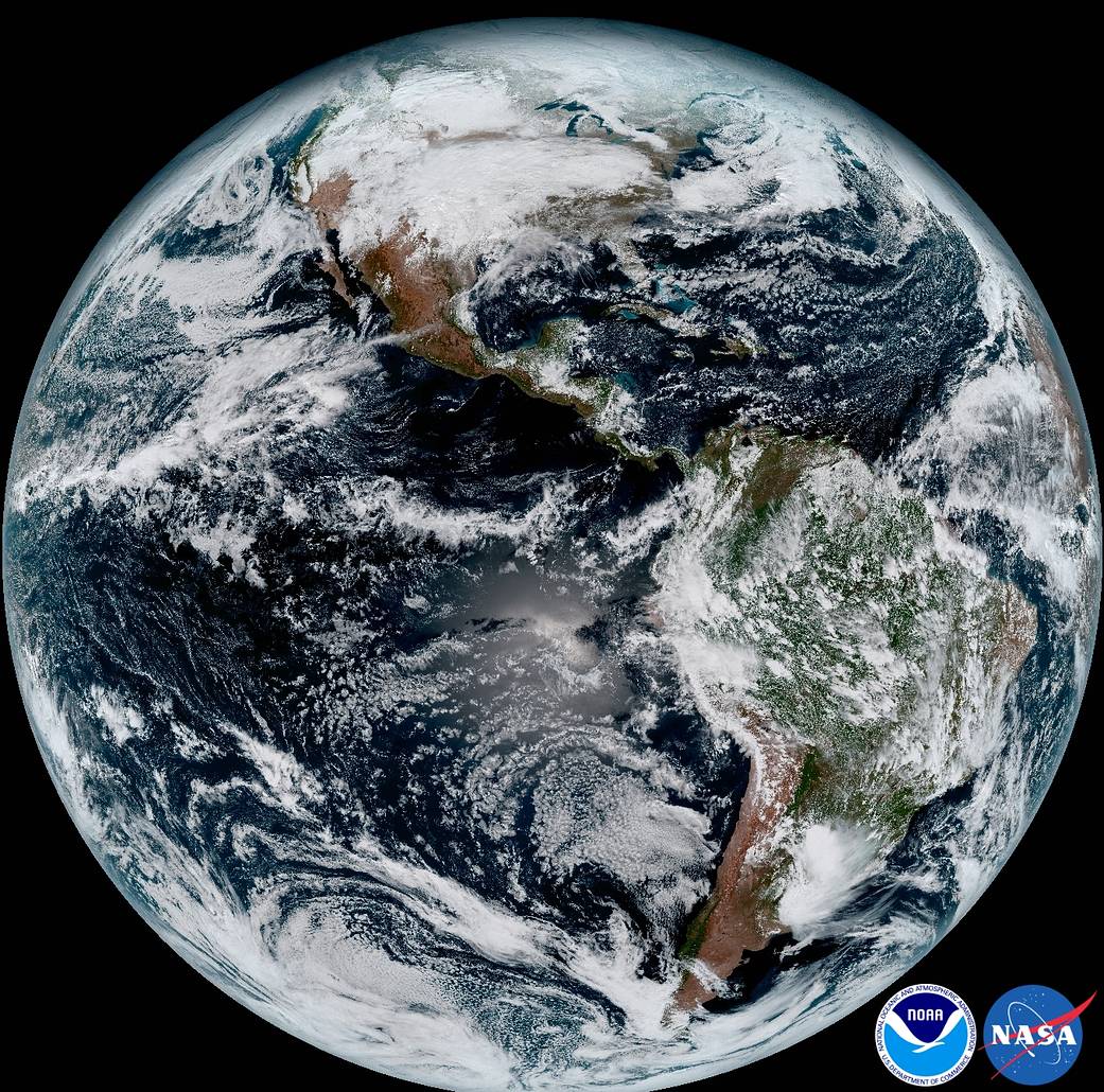
The release of the first images today from NOAA’s newest satellite, GOES-16, is the latest step in a new age of weather satellites. This composite color full-disk visible image is from 1:07 p.m. EDT on Jan. 15, 2017, and was created using several of the 16 spectral channels available on the GOES-16 Advanced Baseline Imager (ABI) instrument.
Image Credit: NOAA/NASA
Last Updated: Jan. 24, 2017
Editor: Sarah Loff
最新気象衛星から届いた最初の地球の画像
NOAAの最新衛星「GOES-16」から送信されてきた最初の画像は、気象衛星の新しい時代の第一歩となります。この地球全体のフルカラー画像は、2017年1月15日の1:07 p.m. EDTに撮影され、GOES-16 Advanced Baseline Imager(ABI)装置で使用可能な16個のスペクトルチャンネルのいくつかを使用して作成されたものです。
訳者注:
いよいよ最新の気象観測衛星の本格稼働が始まります。
この画像はGOES-16が赤道上空高度約22,300マイルから、北米と南米と周囲の海と、西アフリカの海岸からグアムまでを高解像度カメラで撮影しています。
GOES-16は 2016年11月19日に午後6時42分(EST)にフロリダ州ケープカナベラル空軍基地から打ち上げられました。
ちなみにGOES-RからGOES-16に名称変更しましたが16というのは2016年ではなくGOESの16代目ということです。