オリジナル記事:The Splitting of the Dunes
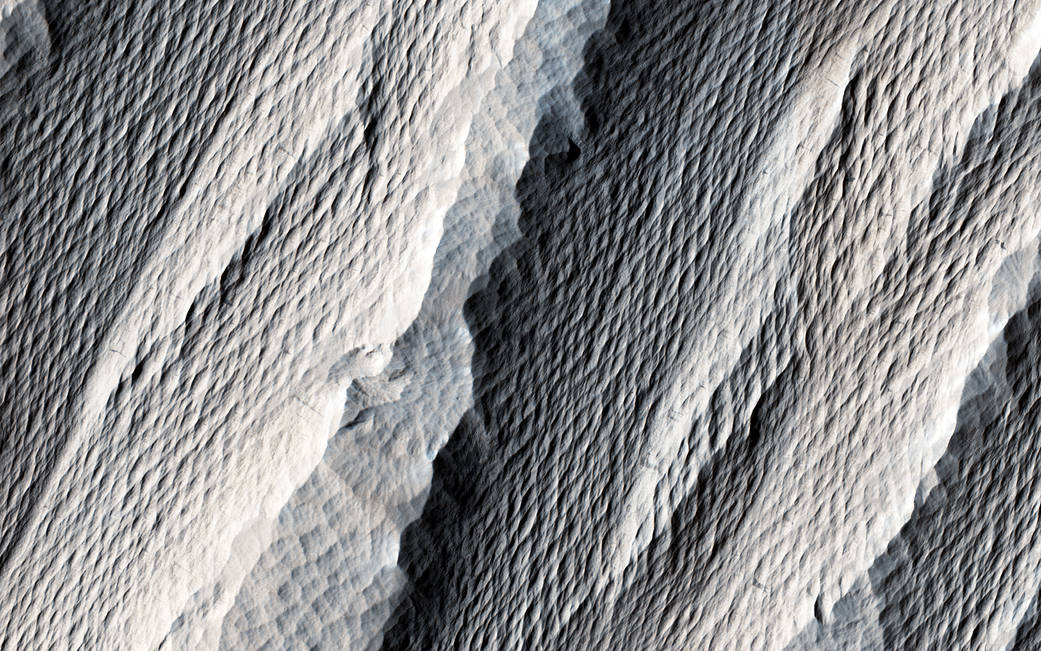
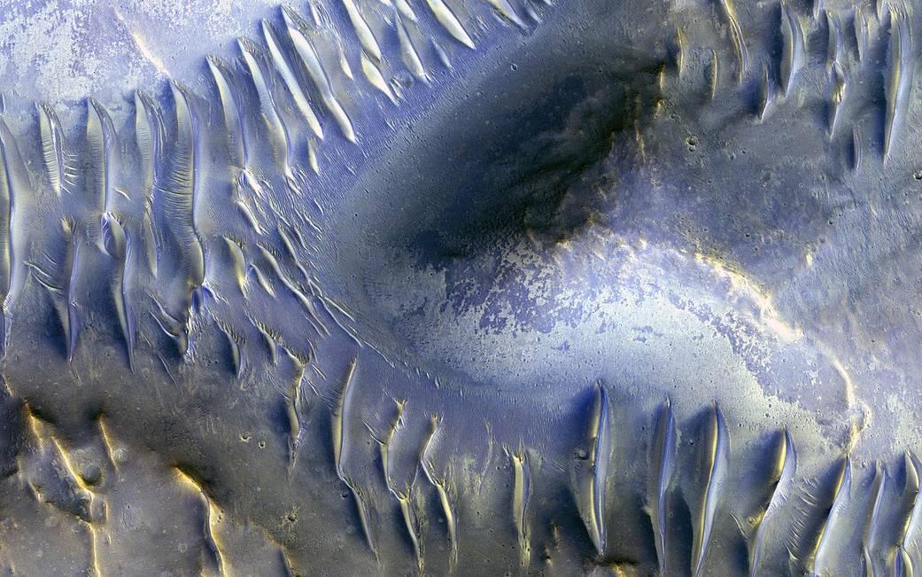
The mound in the center of this Mars Reconnaissance Orbiter image appears to have blocked the path of the dunes as they marched south (north is to the left in this image) across the scene. Smaller dunes run perpendicular to some of the larger-scale dunes, probably indicating a shift in wind directions in this area.
Image Credit: NASA/JPL/University of Arizona
Caption: Nicole Baugh
Last Updated: March 30, 2017
Editor: Martin Perez
砂丘の割け目
この火星観測オービターの画像の中心にある丘が、砂丘が南に進む(この画像の北の方角は左)のをブロックしているように見えます。小さな砂丘が大規模な砂丘に垂直に走っており、おそらくこの地域の風向きの変化を表しているものと考えられます。
訳者注:
この画像は結構古く、2009年4月27日午後15時16分(火星時間)にオービターに搭載された高解像度イメージングカメラ(HiRISE)で撮影したものだということです。35Kmもあるクレーターの近くにある砂丘にあるも地形で中央の丘は粘土状の岩が露出したものだろうと推測されています。
画像解像度はピクセルあたり50センチメートル(9.8インチ)だと伝えています。