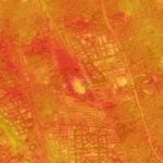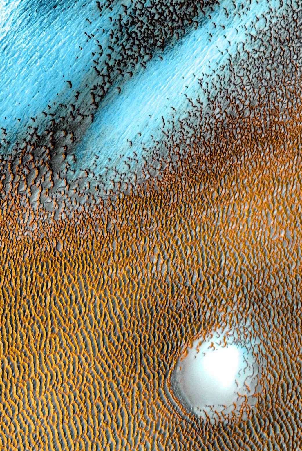
NASAの今日の1枚は、火星の北極で撮影した砂丘の画像です。
これは、2重に勘違いしそうな画像です。
まず、このカラフルな画像ですが、合成着色画像で、このように肉眼で見えるということではありません。
次に、これは火星地表で探査活動を始めたパーサヴィアランスによるものではなく、20年前に火星を周回した探査機オデッセイによる撮影データを加工処理したものです。
では「何で今日の1枚に?」ということですが、今年はオデッセイの20周年記念だとNASAは伝えています。
NASAの公式サイトのURLはこちら:
Blue Dunes on the Red Planet | NASA
以下はオリジナル原文と和訳です。
Blue Dunes on the Red Planet
A sea of dark dunes, sculpted by the wind into long lines, surrounds Mars’ northern polar cap and covers an area as big as Texas. In this false-color image, areas with cooler temperatures are recorded in bluer tints, while warmer features are depicted in yellows and oranges. Thus, the dark, sun-warmed dunes glow with a golden color. This image covers an area 19 miles (30 kilometers) wide.
風によって形作られた長い線状の暗い砂丘の海は、火星の北極を囲むようにテキサス州と同じくらいの広さで拡がっています。 この着色された画像では、気温が低いところは青みがかった色で、暖かいところは黄色とオレンジで塗り分けています。 このように、暗い場所で、太陽で暖められた砂丘は金色に輝いて見えます。 この画像にある部分の面積は、幅19マイル(30 km)になります。
This scene combines images taken during the period from December 2002 to November 2004 by the Thermal Emission Imaging System instrument on the Mars Odyssey orbiter. It is part of a special set of images marking the 20th anniversary of Odyssey, the longest-working Mars spacecraft in history. The pictured location on Mars is 80.3 degrees north latitude, 172.1 degrees east longitude.
この合成画像は、2002年12月から2004年11月までの間に、火星周回探査機マーズ・オデッセイ搭載の熱放射カメラによって撮影された画像を組み合わせたものです。 歴史上最も長く機能している火星探査機であるオデッセイの20周年を記念する特別な画像セットの一部になります。 この画像の地点は、火星の北緯80.3度、東経172.1度です。
Image Credit: NASA/JPL-Caltech/ASU
Last Updated: Apr 8, 2021
Editor: Yvette Smith