オリジナル記事:Space Station Flyover of Hurricane Matthew
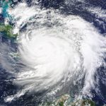
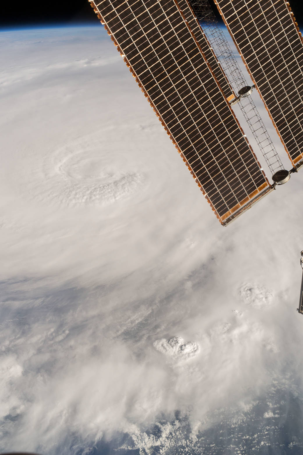
The International Space Station has tracked Hurricane Matthew all week, providing images and video from low Earth orbit as the storm hit the Caribbean Sea and made its way towards Florida. In this photograph taken by Expedition 49 Flight Engineer Kate Rubins on Oct. 4, 2016, at 21:05 GMT, the hurricane’s clouds extend across the frame.
Image Credit: NASA
Last Updated: Oct. 7, 2016
Editor: Sarah Loff
国際宇宙ステーションがハリケーンマシュー上空を通過
国際宇宙ステーションは、カリブ海を直撃しフロリダに向かっているハリケーンマシューを地球軌道上から追跡して画像やビデオをここ毎週にわたって提供しています。この写真は2016年10月4日21:05 GMTに第49次長期滞在クルーでフライトエンジニアであるケイト・ルビンズが撮影したもので、ハリケーンの雲がフレームに収まらずに横切って延びています。
訳者注:
昨日の「今日の1枚」は気象観測衛星からみたハリケーンマシューでしたが、今日は国際宇宙ステーションからみた写真です。
国際宇宙ステーションがハリケーンマシュー上空から観測した様子を動画でTwitterに投稿されています。
Station cameras captured new views of Hurricane Matthew today as the Category 3 storm moved to the north of Cuba. https://t.co/o31A3KRf0A pic.twitter.com/LZCruVhixe
— Intl. Space Station (@Space_Station) October 5, 2016