オリジナル記事:Paw Paw Bends
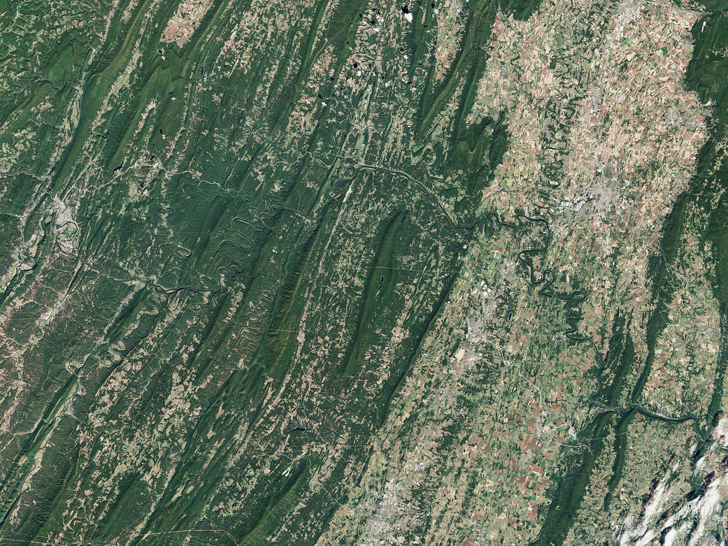
The Operational Land Imager (OLI) on Landsat 8 captured this image of the Potomac River and canal on September 27, 2016. The image shows the stretch between Hancock and Cumberland, Maryland—about 97 kilometers (60 miles) if you were to hike or bike along the towpath between these two towns. West Virginia is south of the river.
Annotated images: NASA’s Earth Observatory
Image Credit: NASA Earth Observatory image by Jesse Allen, using Landsat data from the U.S. Geological Survey
Caption: Kathryn Hansen
Last Updated: Oct. 27, 2016
Editor: Sarah Loff
ポーポーベンド
ランドサット8衛星搭載の地上撮影望遠カメラ(OLI)で、2016年9月27日に、ポトマック川と運河を撮影した写真です。写真ではハンコック、カンバーランド、メリーランドの間が写っています。ここをハイキングかサイクリングするなら、2つの町の間は97キロ(60マイル)もあります。ウェストバージニアはこの川の南側になります。
訳者注:
PawPawというのは、たまに果実屋さんやデパート地下などで「ポーポー」とも「ポポ」とも「ポポー」とも記されて見かけます。
パパイヤとして扱われることもありますが、植物学的には別物です。
ポーポー:バンレイシ科
パパイヤ:パパイヤ科
ポーポー Wiki
温帯で生育する数少ないバンレイシ科の樹木。温帯果樹といっても寒さには非常に強い。
ポーポーの果実
春に紫色の花をつけ、秋には黄緑色の薄い外果皮を持つ果実をつける。問題となる病害虫はほとんどなく、薬剤散布なしでも栽培できる。
