オリジナル記事:Full-Circle Vista With a Linear Shaped Martian Sand Dune
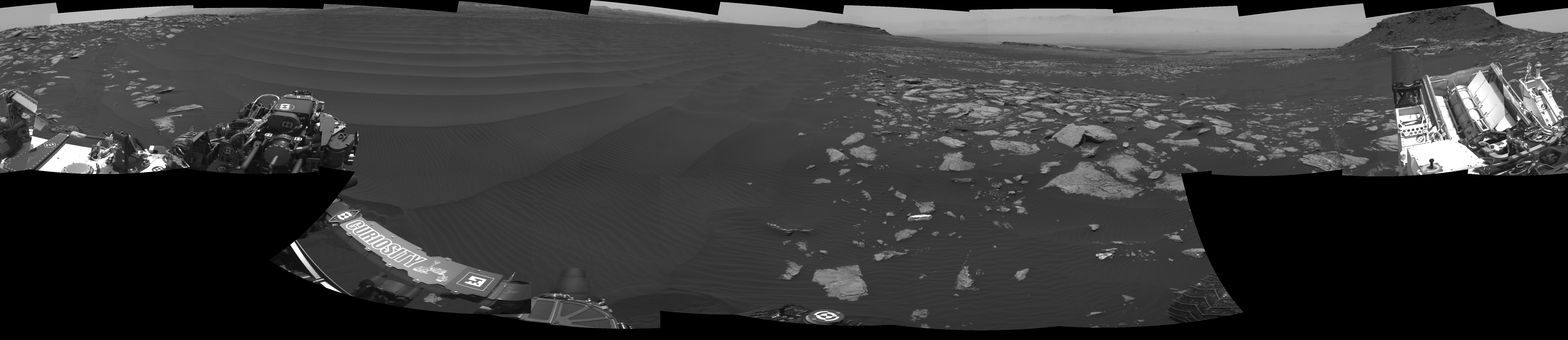
The left side of this 360-degree panorama from NASA’s Curiosity Mars rover shows the long rows of ripples on a linear shaped dune in the Bagnold Dune Field on the northwestern flank of Mount Sharp.
Image Credit: NASA/JPL-Caltech
Last Updated: March 2, 2017
Editor: Tony Greicius
火星の砂丘の全方位視野の画像を並べたパノラマ
NASAの火星探査機キュリオシティのローバーによる360度のパノラマ画像では、シャープ山の北西側にあるバグノールド砂丘地帯の直線状の砂紋の長い列が左側に見えます。
訳者注:
この360度パノラマ画像は2017年2月5日、火星探査機キュリオシティの火星滞在1601日目に撮影された画像を合成したものです。
オリジナル超高解像度画像
画像クリックで拡大表示(7696 × 1669)します。サイズが約4MBありますので環境によっては時間がかかります。