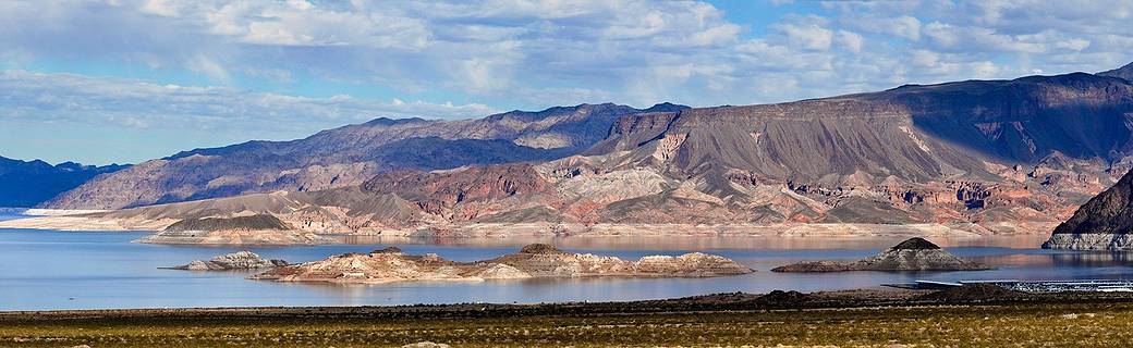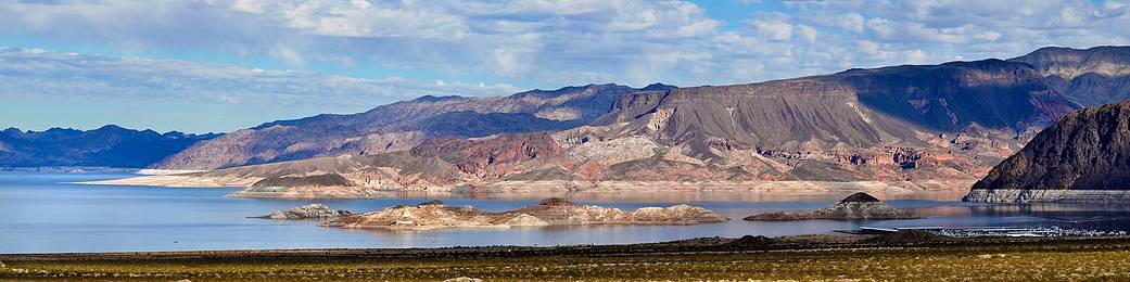
NASAの今日の1枚は、ミード湖の写真です。
このページ最後にオリジナル画像(1024×315)を添付しました。
NASAは観測衛星からレーザー光を使い、地球上の天然資源や陸地の高低などを観測しています。
その解像度は70cmだとNASAは伝えています。
ご参考までに、この記事に関連したNASAによる地球の水質資源についての動画です。
小学校の理科で教わった水の循環の話があります。
NASAの公式サイトのURLはこちら:
Exploring the Earth’s Water | NASA
以下はオリジナル原文と和訳です。
Exploring the Earth’s Water
NASA has investigated humanity’s impact on a number of our home planet’s natural resources and recently explored our impact on freshwater resources. Scientists have now completed the first global accounting of fluctuating water levels in Earth’s lakes and reservoirs – including ones previously too small to measure from space.
NASAは、私たちの地球の多くの天然資源に対する人類への影響を調査しており、今回は淡水資源を調査しました。科学者たちは、地球の湖や貯水池の水位の変動に関する最初の世界的な統計処理をまとめました。今回の処理では、以前は小さすぎて宇宙から観測できなかったものも含まれます。
The research, published March 3 in the journal Nature, relied on NASA’s Ice, Cloud and land Elevation Satellite 2 (ICESat-2), launched in September 2018.
3月3日付けのNature誌で公開されたこの研究は、2018年9月に打ち上げられたNASAの氷、雲、陸の高度を測定する衛星(ICESat-2)の観測結果によるものです。
ICESat-2 sends 10,000 laser light pulses every second down to Earth. When reflected back to the satellite, those pulses deliver high-precision surface height measurements every 28 inches (70 centimeters) along the satellite’s orbit. With these trillions of data points, scientists can distinguish more features of Earth’s surface, like small lakes and ponds, and track them over time.
ICESat-2は、毎秒10,000のレーザー光パルスを地球に照射します。これらのパルスは、衛星に反射して戻ると、衛星の軌道に沿って28インチ(70センチメートル)ごとに高精度の表面高さの測定値となります。これらの数兆のデータにより、科学者は小さな湖や池など、地球の表面のより多くの特徴を区別し、それらを経時的に追跡することができます。
This image is of Lake Mead, which was formed by the creation of the Hoover Dam and lies on the Colorado River just south of Las Vegas.
この写真は、フーバーダムの建設によって生まれた、ラスベガスのすぐ南にあるコロラド川にあるミード湖です。
Learn more about NASA research on our planet’s most valuable resource.
Image Credit: National Park Service
Last Updated: Mar 22, 2021
Editor: Yvette Smith